|
|
Robe
|
|
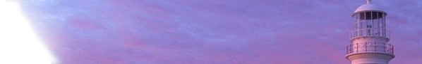
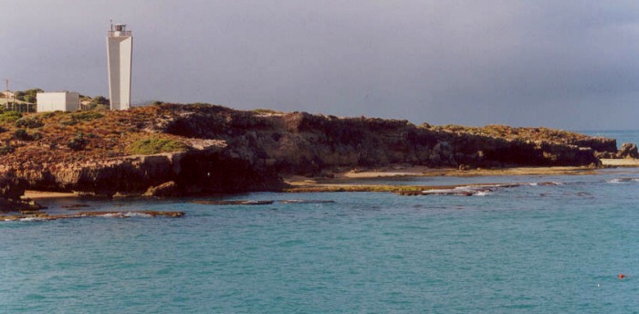
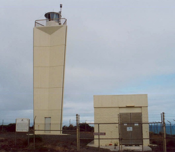
Established in 1973, the Robe Lighthouse augmented the Cape Jaffa Lighthouse which was converted to automatic operation after 100 years of
manual service and was eventually moved to Kingston as a museum. This lighthouse is one of a new design being built within
Australia incorporating the latest electronic optical equipment. The building situated adjacent to the tower houses a standby power plant which
in the event of mains power failure automatically comes into operation and also automatically closes down when mains power supply is restored.
The optic consists of a revolving hexagonal column of sealed beam lamps, showing a character of three flashes every 10 seconds
with an intensity of 410,000 candelas, giving a range of 37 kms. The tower is 18 metres high and 63.1 metres above sea level
|
|
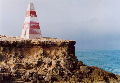 The Robe Obelisk The Robe Obelisk
Erected on Cape Dombey in 1852, the Obelisk was used to navigate the entrance to Guichen Bay and to store rocket lifesaving equipment.
The firing of rockets, carrying baskets to distressed ships to bring passengers ashore, saved many lives. It later assisted passing ships
with navigation because its height of 12m (40 ft) makes it visible 20km (12mles) out to sea.
The erosion of the land surrounding the obelisk will mean it will eventually fall away.
|
|
Robe Township
Situated on Guichen Bay, Robe is about 350kms south east of Adelaide, and has altered very little since the 19th century. Named after Major
Frederick Holt Robe, the Governor of South Australia, who selected the site. The port of Rove was proclaimed in 1847.
Many Irish female migrants and Scottish families arrived in 1855 followed by thousands of Chinese passengers headed for the Victorian Goldfields in
1857. By landing in the free port of Robe and travelling 150km over the
unguarded Victorian border the goldseekers evaded the Victorian Governments
tax of $20 per Chinese landing in that state. This equalled their fare to
Australia.
|
|
|
| Technical / Historical Details | | Nearest Town | Guichen Bay | Height - Elevation | 18.0m (59ft) - 63.4m (208ft) | | Lat/Long: | 37°10.0'S 139°44.7'E | Lantern | | | Construction | White concrete tower | Lens | | | Built | 1973 | Character | Fl.(3)W. period 10s | | First Lit | | Range NM | 20W | | Automated | 1973 | | | | De-activated | | Open | Grounds only | | Architect | | Access | Road | | Reference | 8100 K 2122.8 | Accommodation | No | | See Also: | Cape Jervis | | Sources: | Tourist Information | | Other Links: | | |
|